
← 7 November 2026's Current Affairs · Science & Tech GA Prelims ★★★☆☆ Mains ★★☆☆☆
Quick scan: NISAR, the NASA-ISRO radar satellite
Why in News?
Two radar bands on one satellite: what NISAR's NASA-ISRO SAR means for GS3 space technology
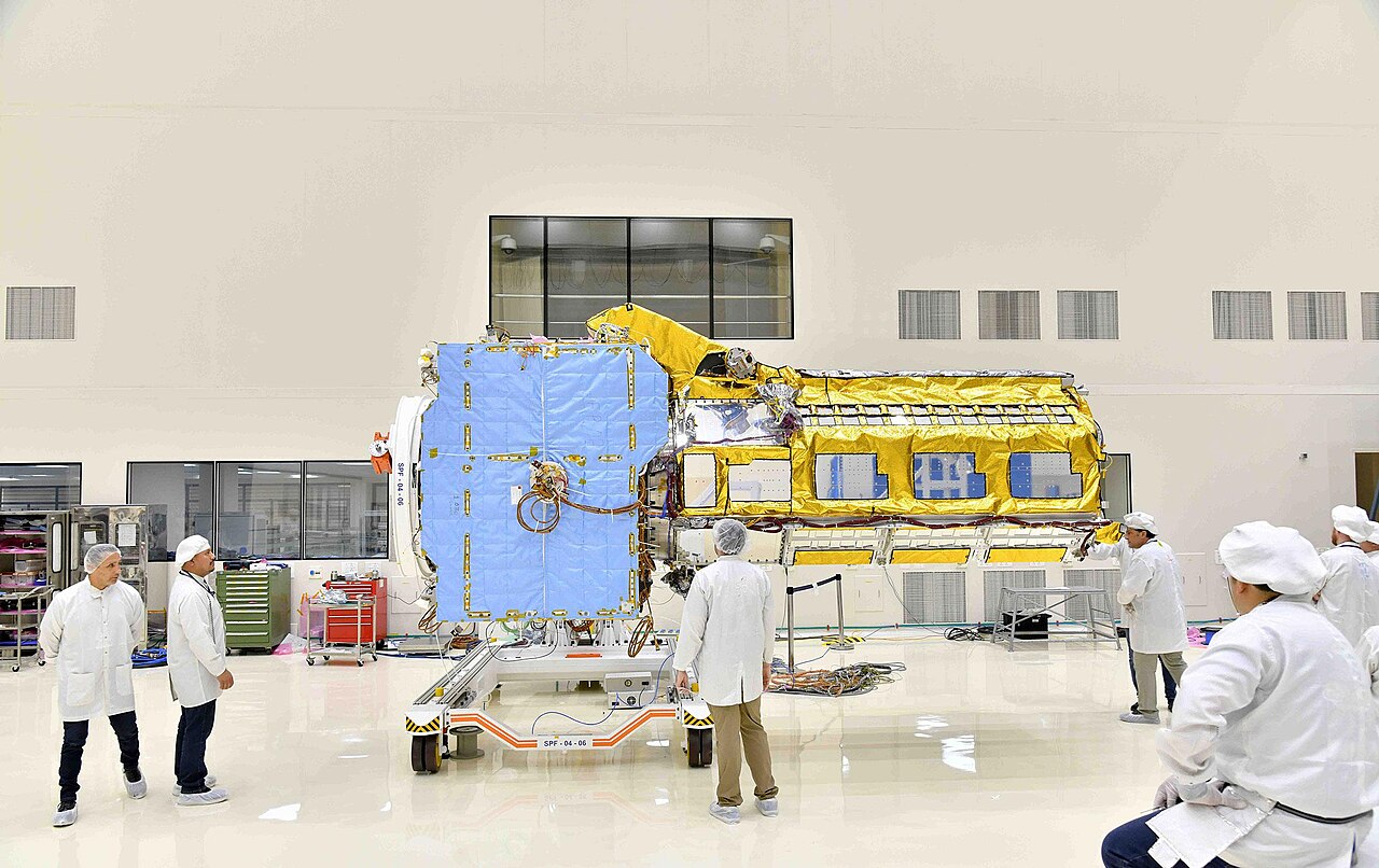
NISAR is the joint NASA-ISRO radar mission for Earth observation.
Why it matters: general awareness
What you need to know
2 min read
NISAR is an Earth-observation satellite built jointly by NASA and ISRO.
It carries synthetic aperture radar and maps changes in land, ice and vegetation across the globe.
Sources: Topper IAS editorial (PIB / The Hindu / Indian Express)
Key facts
Remember these
- NISAR = NASA-ISRO Synthetic Aperture Radar, a joint Earth-observation mission.
- It carries two radars: L-band (built by NASA/JPL) and S-band (built by ISRO).
- Synthetic aperture radar images day and night and through cloud cover.
- Launched in July 2025 by ISRO's GSLV from Sriharikota into a sun-synchronous polar orbit.
- It tracks changes in land, ice and vegetation, including ecosystems, ice sheets and natural hazards.
Prelims · Mains
How the exam will ask it
Prelims
- NISAR is a joint Earth-observation satellite of NASA and ISRO.
- Synthetic aperture radar is an active microwave sensor, so it can image the surface in darkness and through clouds.
- NISAR carries both L-band and S-band radars, which suit different surface features such as dense vegetation and ice.
Mains
GS3 (Science and Technology: space). Earth-observation radar missions like NISAR bring all-weather data for disaster management, agriculture, forest and glacier monitoring. India-US space cooperation also shows how shared costs and expertise can build capacity. The way forward is to integrate the open data into national disaster, climate and agricultural planning while building indigenous SAR capability.
Quick recall
Answer before you reveal
Show answer
Answer: —
Convert this topic into marks
Today's 10-MCQ test · instant analysis · Powered by AdaptIQ